
 Ken
Yeomans
Ken
Yeomans
Ken
Yeomans
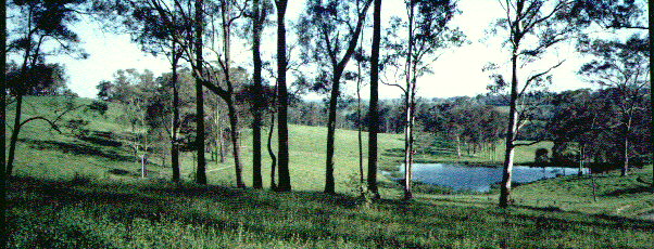
On Keyline properties the typical vistas are of lakes with water birds, roads along the contours and ridge lines, contour tree belts, healthy crops and green pasture growing in dark biologically fertile soil.
ELECTRONIC EDITION
Kindle books can be read nearly all computers, touchpads and
smartphones.
The reader software is free and downloadable from Amazon UK. Ctrl+
CLICK HERE
PRINTED PAPERBACK EDITIONS
Keyline is a set of principles, techniques and systems, which form the logical basis for a practical plan for the sustainable development of rural and urban landscapes.
The first book on Keyline book was published in 1954. In it, P.A. Yeomans exploded the myth that it takes 1,000 years to produce an inch of topsoil. Yeomans pioneered, among other things, the use of on farm irrigation dams in Australian, as well as chisel plows and subsoil aerating rippers. Yeomans perfected a system of exaggerated contour ripping that controlled rainfall run off and enabled the fast flood irrigation of undulating land with out the need for terracing.Although Keyline was initially developed for rural property planning and is superb Landcare it also provides a basis for more sustainable suburban planning and larger subdivisions. Keyline Designs features large earth walled irrigation dams that are all equiped with through-the-wall Lockpipe systems to gravity feed irrigation stock water and yard water. Across the landscape the dams may be interlinked by channels. Graded earth channels broaden the catchment areas of high dams, conserve the height of water and transfer rainfall run-off into the most efficient high dam sites. Flat land flood irrigation at up to sixteen hectares per hour and flood irrigation of undulating grass land. The road systems of Keyline follow both ridge lines and the graded contour water channels. Contour roads and paths, being almost flat, provide easy low energy movement across even very undulating land.
Avenues of trees are left or planted parallel to the roads and channels and as well as in tiered contoured forests. Better building sites become revealed and then fences and gateways can be positioned more strategically. Within this integrated design, soil regeneration can occur by deepening the bio-fertility of the topsoil and converting subsoil into living topsoil. This is achieved partially by soil aeration, which increases water absorption, also by an amplified contour cultivation pattern, which prevents soil wash and by using an enhanced cell grazing design for "rational" grazing. Incidental results are the healing of soil erosion and salinity and better stock health.
In a rural setting Keyline is far more than a unique combination of water conservation and farming with nature. Keyline completely supersedes the widely imposed but misconceived concept of Soil Conservation. One of the typical benefits of Keyline is the rapid development of living soil.
When Keyline Design is applied to urban design the contour roads will assist low energy transport. Water storage within the suburban area will be both picturesque and provide a readily available supply of "yard" water for irrigation of suburban gardens and park. It was back in the 1970's that the originator of Keyline, the late P. A. Yeomans proposed the use of Keyline methods to create City Forests for sewage effluent utilisation.
Click here for a report in an example property at:
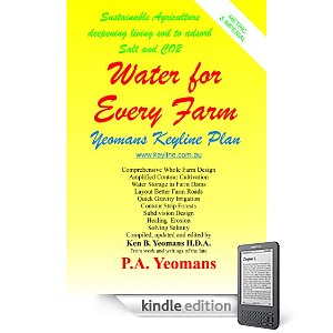
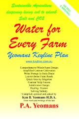
Keyline Designs is the publisher and distributor of the book:
This book on the Keyline system is in both metric and imperial measurement.
Letter received...
" I read a copy of "Water for Every Farm". I think it's brilliant. The best solution I have read to supply all our water needs. As I have a background in geology and interest in perma-culture, quassi-biodymanics (anything organic), I visualise a holistic approach to sustainable land use and care…"
G.F.
Gwandalan, NSW Australia.
The KONDININ GROUP publish a
book called LIQUID ASSETS.
Click here to read the article by Liza Cowper on Keyline
called:
Well-designed landscapes are beautiful and highly productive. In Australia and elsewhere Keyline Designs brings the order of permanence into decision making for rural land design.
Increased profits come from reduced production costs and increased productivity. This is done most efficiently in a landscape specifically designed to achieve this result.
The application of Keyline Designs results in a custom made
property plan. Keyline reveals the potential as well as
developing the unique features of each property. Keyline plans
for optimised farm water utilisation and improving soil
fertility.
(Click here for: Keyline consulting
information)
Your Keyline Designs consultant will reveal the Keyline potential of your property.
Land planning is facilitated by contoured maps. When these
contour maps overlay rectified (true-to-scale) aerial
photographs (think Google Earth), more comprehensive planning
can be achieved.
It is a good investment to obtain a contoured Digital Terrain
Model (DEM) of your land.
[Click here for more details ... ]
![]()
![]()
Since August 8, 1996 this page's Web-Counter
has been tracking visitors to this site and unless
their server is "BUSY" you are visitor number:
From its inception in August 1996 till February 1998 a total
of 2,950 hits were recorded.
From February 1998 to Feb 1999 there were 3290 visits
recorded.
Keyline Designs
P.O. Box 3289 Australia Fair Southport, Queensland, 4215
AUSTRALIA
Phone: +61 (0) 7 5591 6281 Fax: +61 (0) 7 5528 5977
Mobile: +61 (0) 4 1874 5120
Yeomans Keyline Designs / webmaster@keyline.com.au / revised June 2012
"Keyline" is a Registered Trade Mark(™)
© 1996-2012 Keyline Designs